5124 NE 34th Ave. - Portland, OR 97211-7452 - http://www.coasttrails.org - (503) 335-3876
NEWS RELEASE
NEWS RELEASE
FOR IMMEDIATE RELEASE: Thursday, July 31st, 2003
Media Contacts: Al LePage, Executive Director, National Coast
Trail Association, (503) 335-3876
Chris Hathaway, Lower Columbia River Estuary Partnership, (503) 226-1565
ext. 228
Robin Cody, Oregon author of Voyage of a Summer Sun, (503) 774-6187
"Sauvie Island" is Third Reach of Water Trail Traveled on "Bonneville to the Pacific!" Paddle Event
Paddle event continues two week journey of 140 miles traveling proposed Lower Columbia River Water Trail from Bonneville Dam to the Pacific to share water trail vision and highlight its natural beauty, rich history and culture.
Al LePage, Executive Director of the National Coast Trail Association (NCTA), continues traveling some 140 miles by kayak on Wednesday, August 6th from Frenchman's Bar Park in the Portland/Vancouver area, a local park managed by the Vancouver/Clark County Parks Department. He will paddle over the first two weeks of August during the "Bonneville to the Pacific! event to promote public awareness about the proposed Lower Columbia River Water Trail. The new paddler joining him along this third reach of the water trail, known as "Sauvie Island," will be Oregon author Robin Cody, who wrote the book Voyage of a Summer Sun. This book tells the story of his solo 82-day paddling trip in a canoe from the headwaters of the Columbia River in British Columbia to the mouth of the Pacific Ocean! They will travel approximately 14 miles to Sand Island Park in St. Helen's, Oregon on August 6th.. On Thursday, August 7th, they will continue another 13 miles to reach the park at the Port of Kalama. The "Sauvie Island" section itself is about 16 miles in length and technically begins at Kelly Point Park in Portland, Oregon and ends at Saint Helens Marina Docks in St. Helens, Oregon. An special public presentation -- both entertaining and informational -- will be given both by author Robin Cody and LePage at Lower Columbia College in Longview, WA at 1600 Maple Street at 6:30 PM on Thursday, August 7th in the Student Center conference room. Although guided paddling is not available to the public as part of the paddle event, the public can arrange tours along various sections of the trail through various local area businesses. Examples include Alder Creek Kayak & Canoe in Portland, OR; Scappoose Bay Kayaking in St. Helens, OR; and Skamokawa Center in Skamokawa, WA.
"The Sauvie Island section begins where the Willamette's mouth opens wide," notes Al LePage, Executive Director of the National Coast Trail Association, "and travels along some fine countryside! It's obviously a section of the trail that gets one back into the natural scenery of the river. The Ridgefield Wildlife Refuge on the Washington side not only offers the chance to see wildlife, but also was home to a major Indian village site -- a kind of commercial and trading area -- where the Indians prepared Salmon and prepared other goods for trade. A lot of business was once carried on there with many other tribes. Once again, Lewis and Clark noted not only this village, but also wrote about the Sauvie Island area and their exploration up the Willamette River. By the way, Sauvie Island was named after a dairyman living and working there for the Hudson's Bay Company at Fort Vancouver. There's not much dairying there today, but there is quite a bit of farming -- and lots of places for birds and other wildlife to hide -- so make little noise, look carefully, and you might just see some of its many inhabitants."
The Lower Columbia River Water Trail is envisioned as a 146-mile water trail from Bonneville Dam to the Pacific Ocean that people in non-motorized boats can safely travel for day or overnight explorations. The water trail links together seven specific sections or "reaches" along the lower Columbia, each approximately 20 miles long -- about the distance of a typical two-day paddle. Beginning at Bonneville Dam and going downriver these "reaches" are, (1) The Gorge, (2) Portland/Vancouver, (3) Sauvie Island, (4) Kalama/St. Helens, (5) Longview/Rainier, (6) The Refuges, and (7) The Mouth. The journey along its length is spectacular and fascinating, a rich melange of gorgeous landscapes, historical sites, and working ports of call. This free-flowing section of the Columbia River flows through the magnificient Columbia Gorge National Scenic Area with its volcanic cliffs and waterfalls. It also travels along many wildlife refuges; waterfowl abounds at Sauvie Island and Ridgefield, there's Columbian white-tailed deer at the Julia Butler Hanson refuge, and one may enjoy the multitude of marshes and islands of the Lewis & Clark National Wildlife Refuge. Cultural and educational attractions along the river corridor include historical and maritime museums, abandoned riverfront towns, Forts Vancouver and Clatsop, and places where Native American's lived and worked in the past.
"Safety and respect are two of the most important things to carry with you at all times," emphasizes LePage. "First, you shouldn't just throw a kayak or canoe into the Columbia and think you're ready. The Columbia's not a lazy river like the Mississippi; even in summer its waters are cold, its winds are strong, and tides effect the current all the way to Beacon Rock! You need to be prepared in terms of the necessary knowledge, skill-level, and proper equipment to do the specific stretch of river you'll be paddling. A lifejacket is an obvious piece of safety equipment, but I also invested in everything from a VHF radio, to speak with approaching ship captains and send distress signals, to a leash to attach my paddle to the kayak if I flip. Second, a lot of the shoreline along the water trail belongs either to individuals or the public agencies managing their lands for the benefit of wildlife. Those using the trail need to respect landowners and agencies alike by only using places where resting, camping, and access are allowed and obeying the regulations that protect wildlife and their habitat."
The Lower Columbia River Estuary Partnership (Estuary Partnership) has been coordinating the effort to develop the water trail since August 2001 under the direction of Chris Hathaway, Director of Watershed programs for the partnership. The work is being done through the Lower Columbia River Water Trail Committee, with technical assistance provided through the National Park Service's Rivers, Trails, and Conservation Assistance Program. The Committee was formed in September 2001 as a bi-state coalition of people with a diversity of interests and connections to the river. It includes representatives from state and federal agencies, local governments, environmental groups, paddling organizations and businesses, historical associations, economic development councils, trail associations, as well as interested citizens and others. The group works as an ad-hoc committee of the Estuary Partnership, a non-profit bi-state organization funded through the US Environmental Protection Agency and the states of Oregon and Washington. The committee's work has focused on planning, mapping and inventory of facilities for lauching, landing, resting, and camping, identifying local partners and gaining support for the trail concept, public outreach events, and developing a quality brochure.
Robin Cody was born on the Columbia River at St. Helens and grew up in Estacada, Oregon. A graduate of Yale, he taught at the American School of Paris and was Dean of Admissions at Reed College in Portland before taking up freelance writing in 1984. He is the author of Ricochet River, a novel, and Voyage of a Summer Sun, both published by Alfred A. Knopf in hardback and currently available in paperback. Voyage is the account of Cody's 82-day solo canoe trip down the Columbia, from its source in Canada to its mouth at Astoria. With Voyage, Cody won the 1995 Oregon Book Award for literary non-fiction, and the 1996 Pacific Northwest Booksellers Association Book Award. Cody and his wife, Donna, live in Portland, Oregon.
LePage, is an avid hiker, cyclist, and kayaker. He hiked in the footsteps and kayaked in the paddle strokes of the 1805-06 Lewis & Clark Expedition along sections of both the Washington and Oregon coasts during 1999 and 2000. He also retraced -- dressed as the famed mountain man with replica gear -- the Jedediah Smith Trail during 2000 some 200 miles over 3 weeks along the southern Oregon coast on the exact calendar dates it was originally done by Smith in 1828. He most recently retraced the historic 150-mile Alexander McLeod expedition that first explored the central Oregon coast in 1826, doing so by bicycle from Fort Vancouver to Lincoln City, and then on foot -- portraying the not so famous Hudson's Bay Company Chief Trader in authentic period clothing with replica gear -- from Lincoln City to Florence, Oregon. LePage is also the first, and apparently only person, to have ever hiked the entire 1800-mile length of the West Coast Trail, having done the 400-mile the Oregon Coast Trail section in 1988, the 200-mile Washington Coast Trail in 1992, and the 1,200-mile California Coastal Trail in 1996. He also recently received the 2003 Doug Newman Award from the Oregon Parks & Recreation Department for his efforts towards the development of recreational trails in Oregon.
PHOTOS FOR NEWSPAPERS ARE DIRECTLY BELOW THIS PRESS RELEASE
#####
The National Coast Trail Association (NCTA) is a non-profit organization working to "Keep The Coast For Everyone" through recreational trails, public access, and the preservation of historic and natural environments. It is also a member of the Lower Columbia River Water Trail Committee. Visit www.coasttrails.org for organizational and special event details.
The Lower Columbia River Estuary Partnership is a non-profit bi-state organization working in Washington and Oregon to protect and restore the nationally significant lower Columbia River esturay with on-the-ground improvements, education and information programs. It coordinates the efforts of the Lower Columbia River Water Trail Committee. Visit www.lcrep.org for further information.
--------------------------------------------------------------------------------
The following two photos may be used by the newspaper print media
and cropped and color-balanced as necessary.
They are high resolution photo images of 300 dpi suitable for print
quality.
Please credit the National Coast Trail Association.
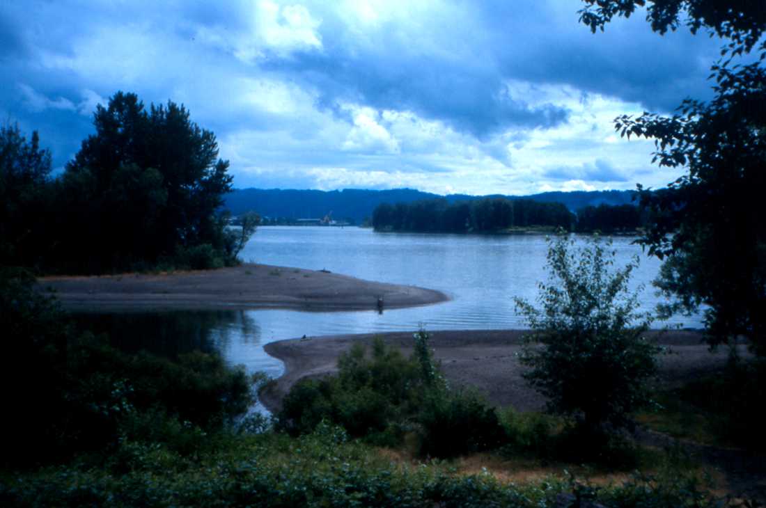
"Sauvie Island" is the third of seven"reaches" along the Lower Columbia River Water Trail.
This idyllic setting, looking across to Sauvie Island itself,
is downriver
from where the Willamette River enters the Columbia and just
above
Frenchman's Bar Park in Vancouver, WA.
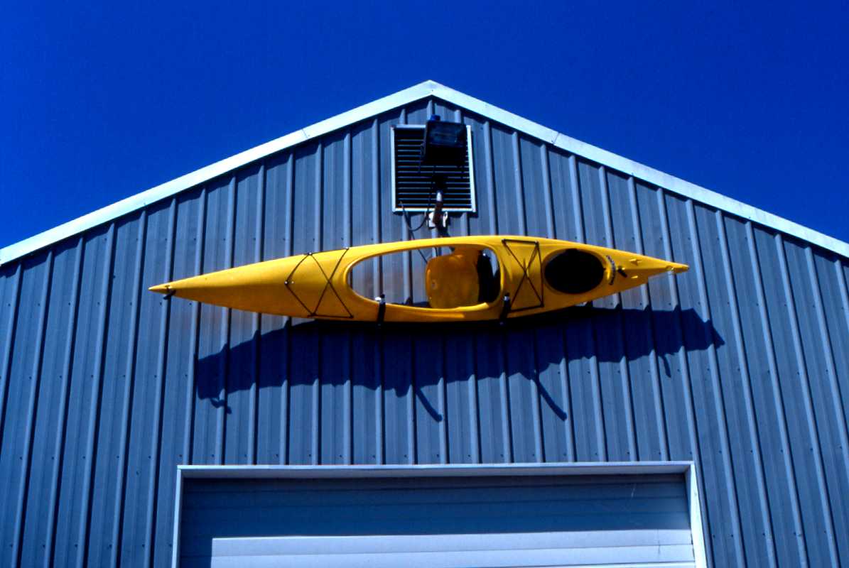
Scappoose Bay Kayaking in St. Helens at the Scappoose Bay Marina
usually
has . . . at least one kayak "hanging around" for recreation
along the water trail.